Kriegsmarine Marinequadratkarte
by Michael Emmerich
During World War 2, the German Navy used a special system to define positions on sea. It did not use the normal longitude and latitude system which is used today but its own system - the so called Marinequadratkarte
. This was done to cover the real location of a ship and to find an efficient and short way to report positions via radio transmissions. For example, U-boats had to shadow allied convoys and transmit their position and course quite often to enable other U-boats to get in contact with the convoy and do a simultanious attack by several boats.
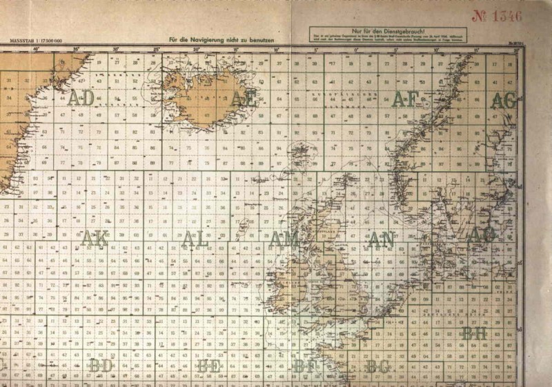
Marinequadratkarte
The system was based on the subdivision of the ocean into square areas, the so called Großquadrate
. Each of them was labled with a two letter code, e.g. AN described the North Sea Großquadrat or CA the American east coast in the New York area. Those Großquadrate were not all of the same size and shape, this depended on the loacation on the globe and tactical reasons. For example the AN and AM quadrants around the British Islands were quite irregular shaped while those in the middle of the Atlantic Ocean – like CB or CD – were regular squares.
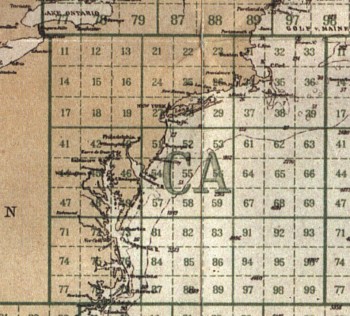
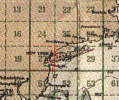
Großquadrat CA - The USA Westcoast in the Area of New York
|
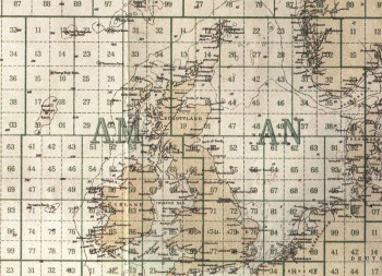
Großquadrate AM (British West Coast) and AN (North Sea)
|
To give an idea of the size of those Großquadrate, the AC quadrant (area of the North Cape) had an edge size of 486 sea miles.
The Großquadrate were subdivided into nine quadrants in a 3-by-3 grid, labled from 1 to 9. In case of Großquadrat AC, each of those medium squares had an edge size of 162 sea miles. A position in one of the nine subdivisions of a Großquadrat was named with the name of the Großquadrat, followed with the number of the square. Each of the medium squares was again subdivided into 9 squares. With this, every Großquadrat was subdiveded into 81 smaller squares, which were labled from 11 to 99 – without the numbers containing a 0. To describe a postion within one of those smaller squares – which had an edge size of 54 sea miles - a two letter and two number code was needed. E.g. AC71 would describe a postion off the Norwegian North coast.
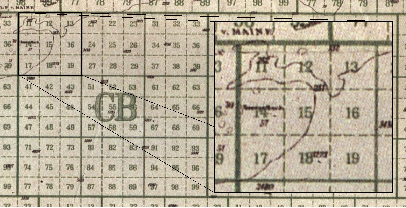
Subdivision of the Großquadrat CB in 81 smaller quadrants. The zoomed in part is the quadrant CB1 with its nine subdivisions CB11-CB19
Each of those 81 squares was again subdivided into 81 smaller squares, each covering a 6 x 6 sea mile part of the ocean. Again, those small squares were labled from 11 to 99, a location like “CA2745” would describe such a 6 x 6 sm part of the sea. In this example, those coordinates would point into the middle of New York harbor.
New York Harbor in the Marinequadratkarte
Such a location could be described with a 6 character code, two letters and 4 numbers, which was a very efficient way to transmit such a position. If a larger area than the 6 x 6 sea mile section was ment - like CA27 or CB1 - the missing digits were filled up with zeros. In this example the complete code would be CA2700 and CB1000.
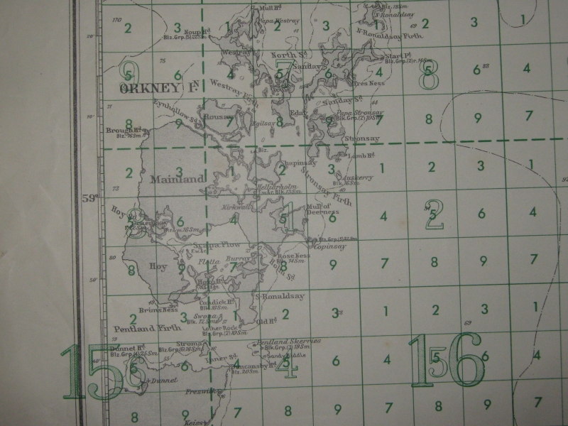
Another exmaple for a Marinequadratkarte is the following picture of the Orkeny Islands with Scapa Flow:
Thanks to Pino Esposito of www.kartengruppe.it for providing the map.
Notes:
The Kriegsmarine Marinequadratkarte images are scanned from a map replica included in the computer game Aces of the Deep
by Dynamix Inc, (C) Dynamix Inc 1994
|