During the Second World War the German Navy used its own geographical grid instead of transmitting normal longitude and latitude. The Marinequadratkarte concealed the immediate meaning of a position and reduced it to a short code suitable for radio traffic.
Why use a separate grid?
U-boats shadowing an Allied convoy had to report position and course repeatedly so that other boats could assemble for a coordinated attack. A short standardized coordinate was faster to transmit and less revealing to anyone intercepting an incomplete message.
The system was based on successive subdivisions. Each additional pair of digits narrowed the reported area until a six-character code represented a square measuring approximately six by six nautical miles.
Ocean regions
Großquadrate
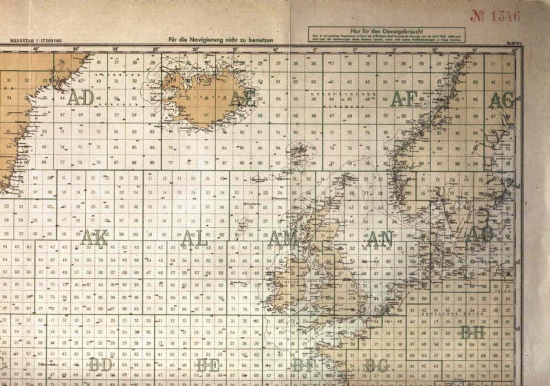
The oceans were divided into large areas identified by two letters. AN covered the North Sea, while CA included the American east coast around New York. Their size and shape varied according to geography and tactical requirements.
First level
Nine fields
Each Großquadrat was divided into a three-by-three grid numbered 1 to 9. Großquadrat AC near the North Cape measured about 486 nautical miles across, making each of its first subdivisions approximately 162 nautical miles wide.
Second level
Eighty-one fields
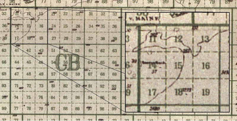
Every field was subdivided again into nine. A Großquadrat therefore contained 81 fields labelled 11 to 99, excluding numbers containing zero. A code such as AC71 identified an area about 54 nautical miles across.
Final level
Six nautical miles
Each of the 81 fields was divided once more into another set of 81. The complete code used two letters and four digits and identified an area roughly six by six nautical miles.
A worked example: CA2745
The letters CA select the Großquadrat covering part of the American east coast. The first pair, 27, selects one of its 81 medium fields. The final pair, 45, selects one of the 81 smallest squares inside CA27. The resulting position lies in the New York Harbor area.
If a report referred to a larger area, unused digits were replaced with zeros. CA27 could therefore be transmitted as CA2700, while the broader field CB1 became CB1000.
Examples from the chart
The collection includes examples showing how regular Atlantic grids and irregular coastal grids were adapted to the geography. Select any map to inspect the larger scan.
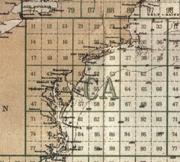
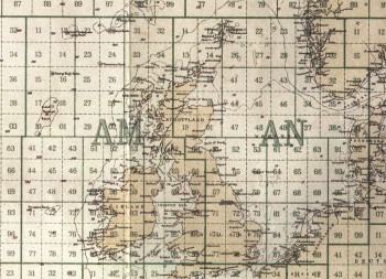
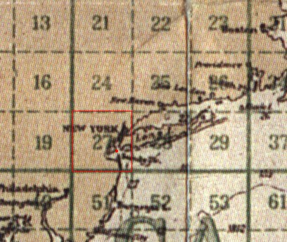
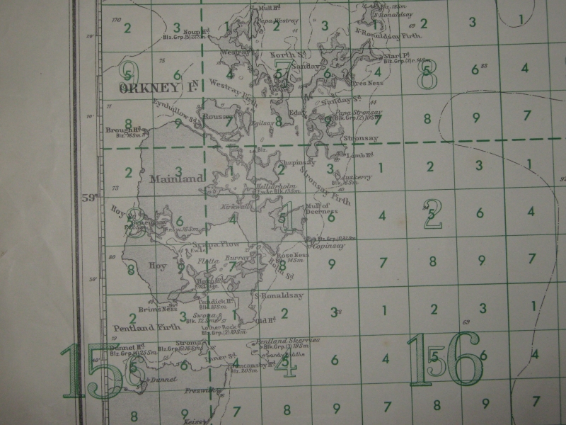
Image and source note
The Marinequadratkarte images were scanned from a map replica included with the computer game Aces of the Deep, Dynamix Inc., 1994. The Scapa Flow map was provided by Pino Esposito of Kartengruppe.it. They are retained here as attributed historical reference material.